For sale


Guide price
£600,000
Having knowledge of the purchase price allows you to calculate the overall expense incurred in acquiring the property. Read our glossary page
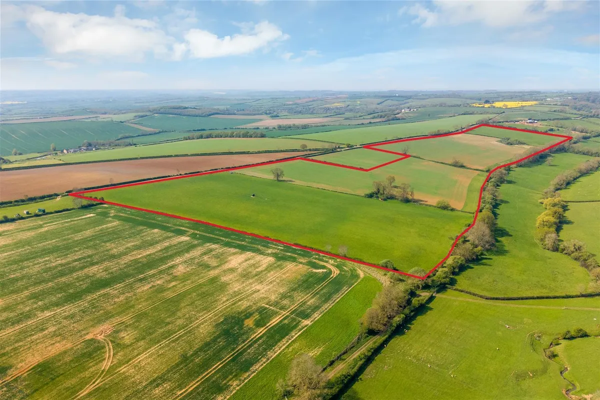
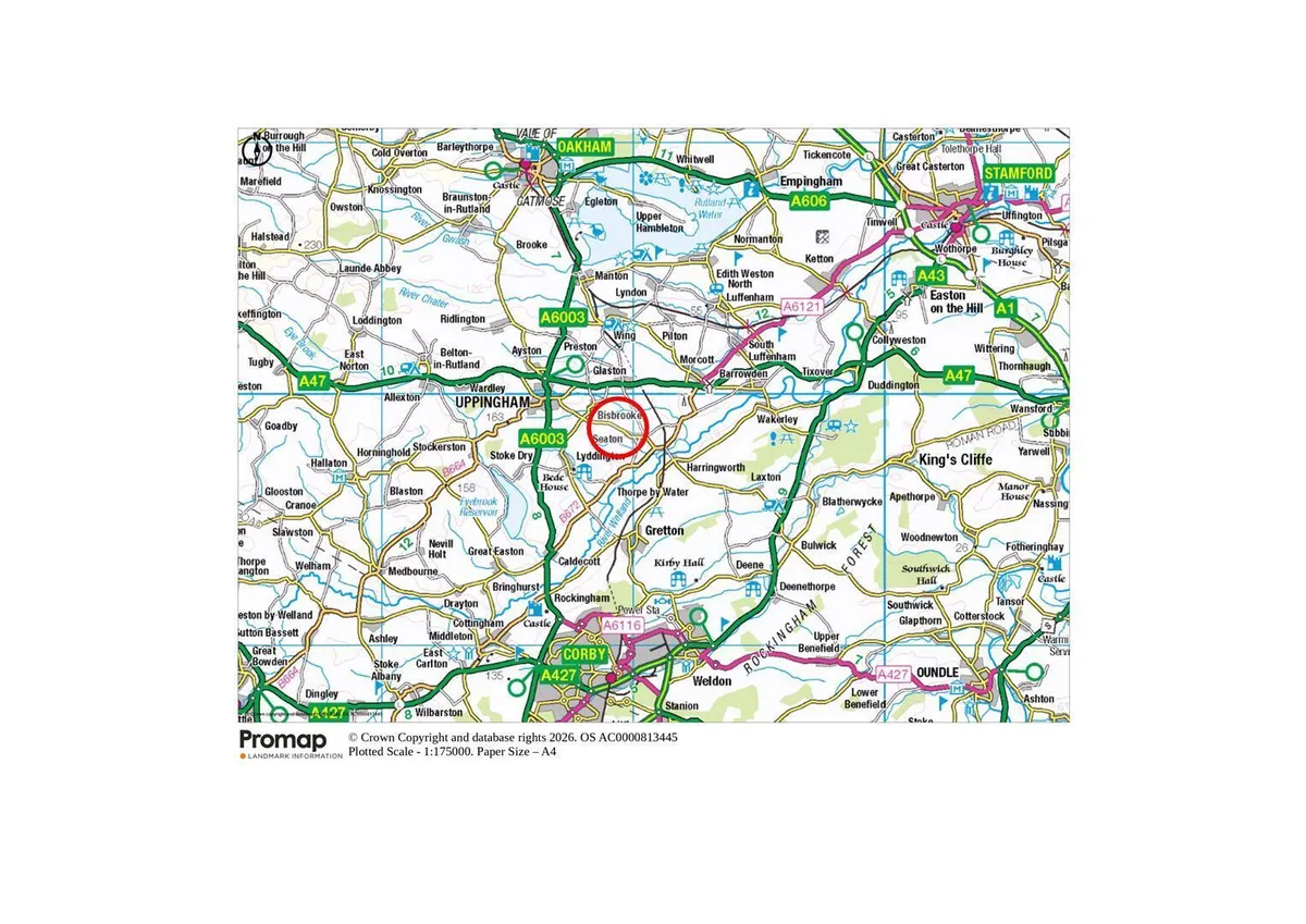
Arable & Pasture Land at Bisbrooke, Rutland - about 67.36 acres
About this property
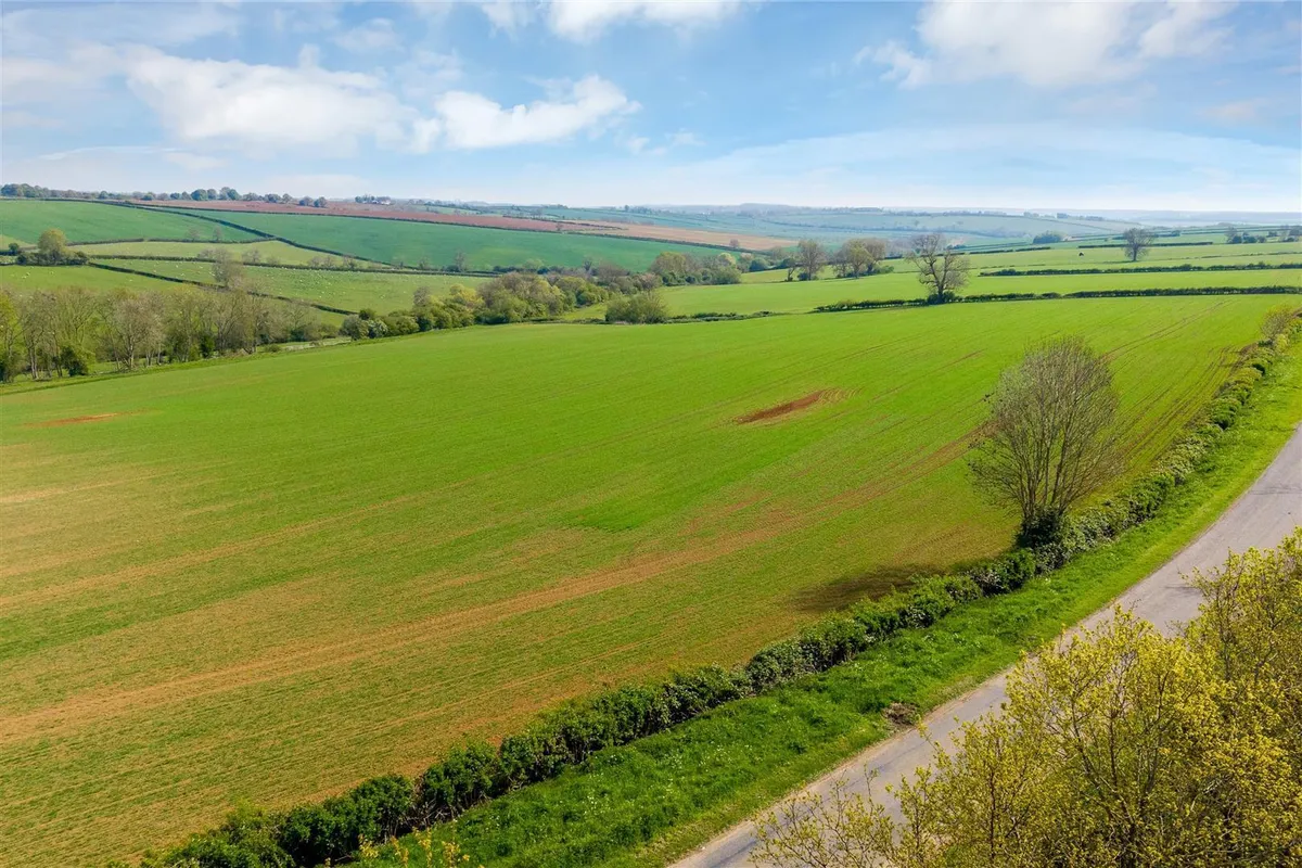
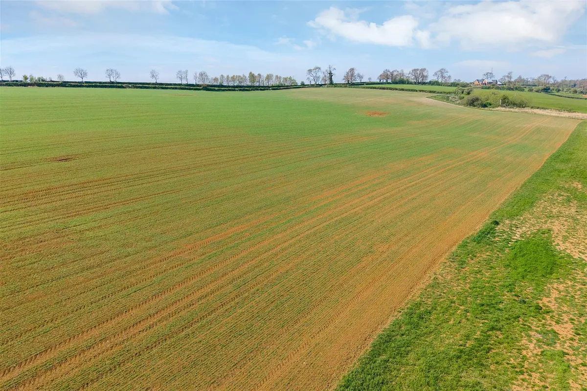
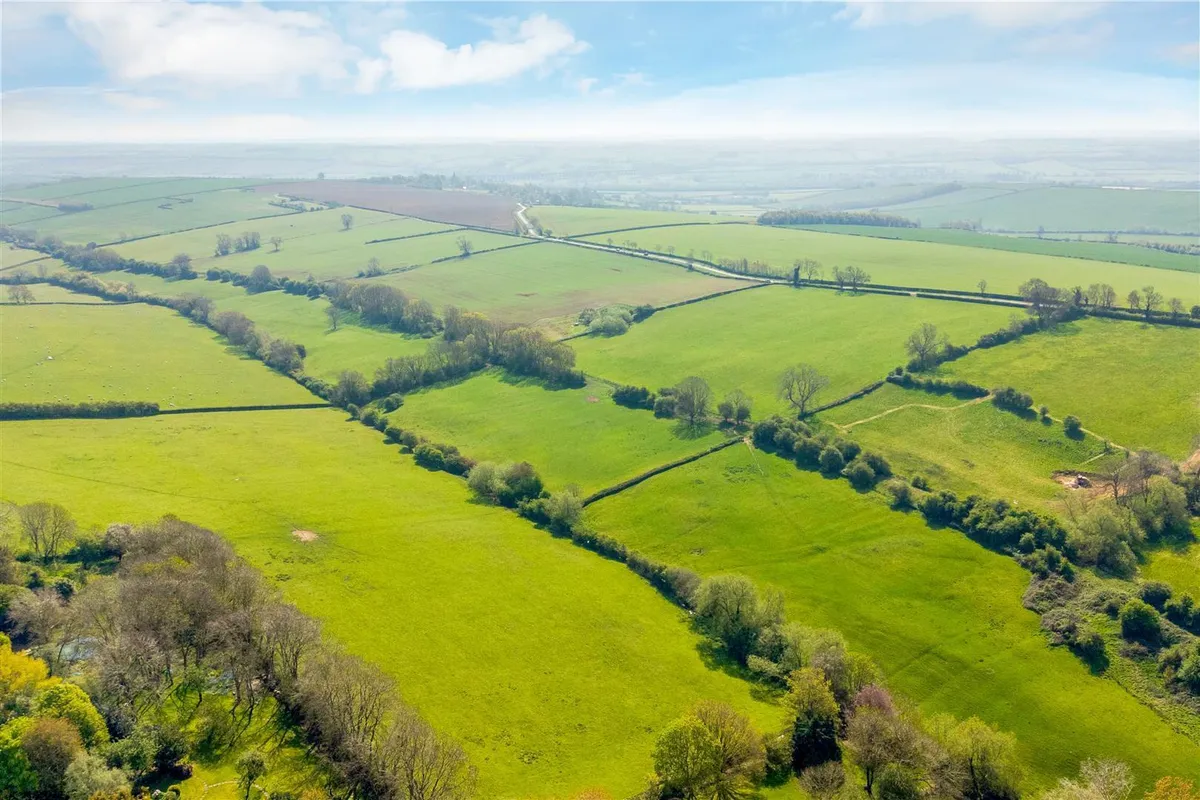
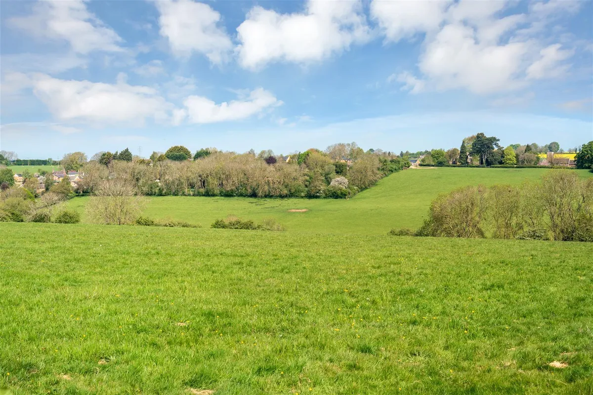
- A block of arable and pasture land located in the Welland Valley
- Uppingham 1 mile, Oakham 7 miles, Corby 8½ miles, Stamford 11 miles
- Grade 3 arable land
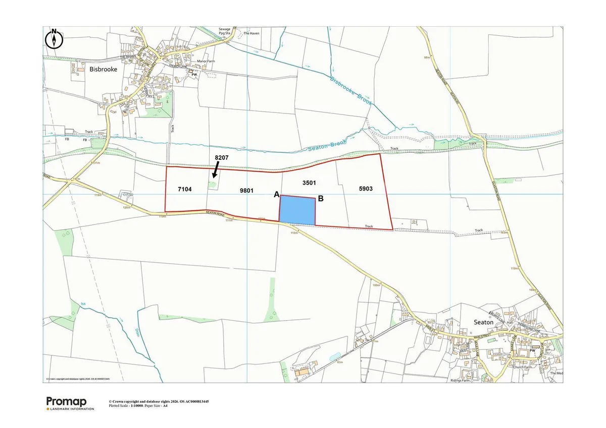
- About 67.36 acres (27.26 hectares) in total, with approximately 5.63 acres (2.28 hectares) available to purchase separately.
- For sale as a whole
- Guide Price £600,000
Council Tax A fee submitted to your local authority to cover expenses related to local amenities such as schools, libraries, and waste management. The payment amount is determined based on the property's value. Read our glossary page :
Use Class A commercial use class refers to a classification system that categorises buildings based on their intended commercial purposes, such as offices, retail spaces, or industrial facilities. Read our glossary page
ASK AGENT
Material information
ExpandUppingham 1 mile, Oakham 7 miles, Corby 8½ miles, Stamford 11 miles
Grade 3 arable land
About 67.36 acres (27.26 hectares) in total, with approximately 5.63 acres (2.28 hectares) available to purchase separately.
For sale as a whole
Guide Price £600,000
Map
Train stations
Yield calculator
Stamp duty calculator
Similar properties


Need a Valuation?
Need a Valuation?Our team of experts will get the best price for your property.
Book a valuation Find out how muchyour property is worth
Can't find what you're looking for?
We're here to help! Contact us today and let our expert team assist you in finding exactly what you need.
Contact Us